
Scenic Routes vs. Interstates: What Each Type of Road Actually Offers

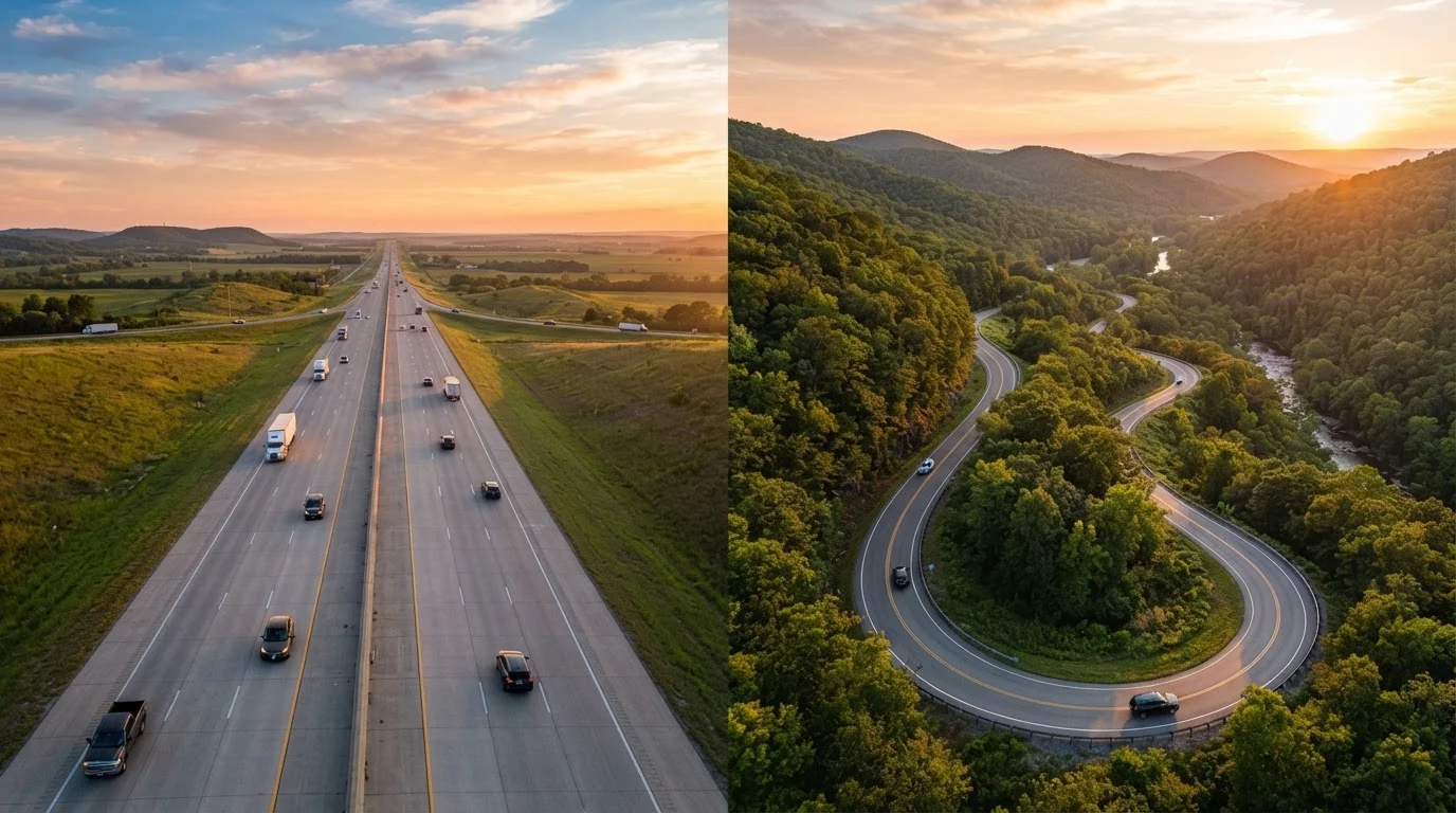
Photo: ShortwebArticles.com | Content For The Curious editorial
Key Takeaways
- Interstates prioritize speed, reliability, and consistent services over scenery or discovery.
- Scenic byways offer landscapes and local culture that highways simply bypass.
- Smart road trippers often blend both road types rather than committing to just one.
- Scenic routes typically add time and require more fuel planning but reward the detour.
- Your destination, schedule, and travel style should drive the choice between road types.
What Interstates Actually Deliver
The Interstate Highway System spans more than 48,000 miles and was built with one core goal: move people and goods efficiently across long distances. That engineering intent shapes every aspect of the driving experience.
On an interstate, you get predictable lane widths, gentle grades, and consistent signage. Rest areas, gas stations, and chain restaurants appear at regular intervals — typically every 30 to 50 miles. Speeds are high, passing is easy, and navigation is nearly foolproof. For covering 500-plus miles in a day, there's genuinely no better tool.
Interstates also offer safety advantages. Controlled access means no cross-traffic, no stop signs, and no unexpected turns. Emergency services are faster to reach. For drivers with young kids, older passengers, or vehicle reliability concerns, that predictability has real value.
The trade-off is environmental monotony. Much of the interstate corridor is a tunnel of sound walls, truck stops, and identical green signs. You're moving through the country, not experiencing it. For context on how this affects your overall trip format, see our comparison of coast-to-coast vs. regional loop road trips.
| Interstate Highways | Scenic Byways | |
|---|---|---|
| Typical speed | 65–80 mph | 25–55 mph |
| Fuel & services availability | Frequent, predictable | Sparse, plan ahead |
| Scenery | Minimal, industrial | Landscape-defining |
| Navigation complexity | Simple, well-signed | Variable, research needed |
| Seasonal reliability | Year-round in most regions | Some routes close seasonally |
| Local culture access | Limited | High — towns, food, history |
| Miles covered per day | 400–600+ realistic | 100–250 typical |
| Best use case | Bridging long distances fast | Experiencing a specific region |
What Scenic Byways Actually Deliver
The Federal Highway Administration's National Scenic Byways Program designates routes based on archaeological, cultural, historic, natural, recreational, and scenic qualities. There are currently more than 150 designated byways across the country — and that doesn't include hundreds of equally rewarding state-designated routes.
On a scenic road, the drive IS the experience. Think of the Blue Ridge Parkway threading through the Appalachians, the Going-to-the-Sun Road in Glacier National Park, or the Loneliest Road in Nevada cutting across ancient desert basin. These corridors expose you to the texture of a place — its geography, its small towns, its roadside food and local character — in a way that no interstate can replicate.
Scenic routes also create natural stopping points. You're more likely to pull over for a waterfall, wander into a state park, or stumble into a roadside diner that becomes the highlight of your trip. Our guide to why road trippers miss their best stops explores exactly why slowing down matters.
The honest cost: scenic routes are slower, sometimes significantly. Two-lane roads behind RVs, low speed limits through towns, and fewer fuel and food options all require more planning. Some byways are seasonal or weather-dependent. Verify current road conditions and access through official state DOT or federal land management websites before you go.
Download Offline Maps Before You Go
Key Differences at a Glance
Choosing between road types isn't about which is objectively better — it's about matching the road to what you need at each leg of your trip. Some segments of a journey call for covering ground; others call for soaking it in. The table below compares the two road types across the criteria that matter most to road trippers.
Want to see these differences in action across specific famous corridors? Our breakdown of iconic US road trip routes covers how each famous stretch actually drives.
150+
Federally designated scenic byways in the US
The Federal Highway Administration's National Scenic Byways Program recognizes routes across all 50 states for their outstanding scenic, cultural, or historic qualities.
48,000+
Miles in the US Interstate Highway System
The Dwight D. Eisenhower National System of Interstate and Defense Highways is the backbone of long-distance American road travel, according to the Federal Highway Administration.
~239M
Americans who drove for leisure in a recent year
Road travel consistently ranks among the most common domestic leisure activities in the US, according to tourism research organizations tracking American vacation habits.
How to Blend Both Road Types Effectively
The most experienced road trippers treat interstates and scenic byways as complementary tools rather than rivals. A practical approach: use interstates to bridge between regions quickly, then exit onto scenic corridors once you're in the area you actually want to explore.
For example, you might drive an interstate to reach the general vicinity of the Ozarks or the Texas Hill Country, then spend two to three days on two-lane state roads before jumping back on the highway to reach your next destination. This hybrid approach keeps your total driving time manageable while maximizing the richness of your experience.
When planning, map your scenic segments first — identify the stretches where the landscape or culture warrants slowing down — and build your interstate legs around them. Apps and mapping tools that show road classifications can help, but cross-reference with road and driving tips for practical guidance on navigating unfamiliar routes safely.
If you want inspiration for the roads worth the detour, our roundup of lesser-known road trip destinations is a strong starting point. And if your route runs near public lands, our guide to national parks vs. state parks vs. national forests will help you understand what each type of land actually offers before you arrive.
Above all, build slack into your schedule. The greatest enemy of scenic driving is an over-packed itinerary that forces you to skip the very things that make a road trip worth taking.
Don't Let Scenic Roads Become a Rush
The content on this site is for informational purposes only and is not a substitute for professional advice. Always consult a qualified professional for guidance specific to your situation.